- Home
-
Products
We can image for you and supply the samples according to your request
CONTACT US NOW - Solutions
- Industries
- Company
- Innovation
-
Support
- Contacts
-
We can image for you and supply the samples according to your request
Mide is the professional manufacturer (OEM) that develops and manufactures GNSS antennas and Receivers for high-precision positioning applications worldwide.
Geodetic Antenna
Helix Antenna
GNSS Choke Ring Antenna
GNSS Aviation Antenna
Timing Antenna
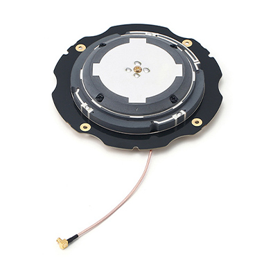
Geodetic antenna has the ability of multi-satellite system navigation and positioning, and can receive various types of navigation system full-band signals. Using unique geodetic grade techniques, the phase center is stable, which provides excellent anti-multipath interference ability and ensures the sensitivity of receiving satellite signals.The geodetic grade antenna is able to receive low elevation signals with high gain and wide beam width makes it an excellent choice for tracking visible satellites under challenging conditions, providing the positioning solutions with precision and reliable data. GNSS geodetic grade antenna can be widely used in agriculture tractors, unmanned vessels, also for autonomy vehicles, GIS surveying where high precision operations are needed. Mide, as a professional manufacturer and supplier of geodetic grade antennas, provides geodetic grade GPS/GNSS antennas, equipment, technology, etc.MIDE can provide the customization options mentioned above to ensure that GNSS antennas and receivers meet the diverse needs of customers. The specific customization options include:Mechanical Structure and Appearance: MIDE customizes the physical design and external structure of the antennas and receivers according to customer requirements, including size, shape, and mounting options to suit different application scenarios.Electrical Performance Indicators: MIDE tailors the electrical performance characteristics of the antennas and receivers, such as signal strength, frequency range, and power consumption, to ensure optimal performance in various environments and usage conditions.Customization for Different Application Scenarios: MIDE adapts the equipment to meet the specific needs of different applications, such as surveying, navigation, or industrial uses, adjusting both performance and design to meet particular technical requirements.Environmental Adaptability (IP Protection Level): MIDE offers customized protection designs for the products to enhance their resistance to water, dust, or extreme temperatures, ensuring stable operation in various environmental conditions. This is typically indicated by the IP (Ingress Protection) rating.Connection and Cable: MIDE customizes the connections and cables used with the antennas and receivers based on the customer's equipment system requirements, ensuring compatibility with other devices.Brand and Appearance Customization: MIDE also offers branding and aesthetic customization services, helping customers align the product with their corporate identity or visual preferences.With these customization options, MIDE provides GNSS antennas and receivers that are fully tailored to meet the specific needs of customers, ensuring both functional performance and aesthetic satisfaction.
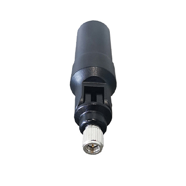
GNSS Helix AntennaProfessional helix antenna is a sophisticated helix-shaped design of GNSS antenna, can send and receive polarized electromagnetic signals rotating in space. Use unbalanced feeder, such as coaxial cable to connect the antenna, the center of the cable is connected to the helix part of the antenna, and the sheath of the cable is connected to the reflector.Sophisticated gps helical antenna design for high precision positioning services and excellent tracking of satellite signals including GPS, GLONASS, GALILEO and BeiDou. . Its RTK level positioning accuracy makes it ideal to be integrated into application as surveying and mapping, and various UAVs operations.Key Features* Helical antennas are small, lightweight, and require no ground plane, making them adaptable and easily retrofittable, Helical antennas are ideal for UAV applications.* Multi-band Capability: These gnss helix antennas cover multiple frequency bands, including GPS/GLONASS-L1/L2, BD B1/B2/B3, and GALILEO E1/E2/E5a/E5b, providing comprehensive coverage for various applications.* Advanced Patented D-QHA Technology Ensures reliable signal tracking at low elevation angle.* High Precision Positioning: GPS helix antenna's stable phase center ensures millimeter-level positioning accuracy.Gnss Helical Antenna Application FieldThe sophisticated helix antenna design allows GNSS helix antennas to be widely used in UAVs. In this way, UAV aerial survey has the characteristics of flexibility, high efficiency, low operation cost, wide application range and short production cycle. In recent years, the UAV industry has developed rapidly. Sophisticated helix antenna has been widely used in surveying and mapping, precision agriculture, disaster monitoring, traffic patrolling , security monitoring and other fields. Especially in field work, it reduces the workload of operators and speeds up the operation efficiency.GPS/GNSS Helix Antenna ManufacturerMide as a professional helix antenna manufacturer and supplier, providing high gain sophisticated helix GPS/GNSS antenna development and design, our helix antennas are used in various antenna solutions. Welcome to contact us for professional helical antennas!

GNSS Choke Ring AntennaChoke ring antenna is a high performance GNSS antenna for base station that can track GPS, GLONASS, BeiDou, BeiDou Global and Galileo. The choke ring antenna design can meet the requirements of high precision and multi-system compatibility of measurement equipment. The choke ring GPS antenna phase center of this product has high stability and high positioning accuracy. And GNSS choke ring antennas have specially designed filters that reduce multi-path signals in the L1 and L2 bands of the same antenna configuration. Choke ring antennas are notable for their ability to reject multi-path signals from a source.The GPS choke ring antenna offered by Mide is a mini choke ring antenna with strong multi-path suppression performance, specifically designed for land surveying, precision agriculture, deformation monitoring, CORS and related GNSS applications require absolute positioning accuracy and multi-constellation support. These choke ring GPS/GNSS antenna details are perfectly finished and each antenna is proven to provide accurate data to meet the operator's needs and ensure stable performance over time. The Core Technology Of Choke Ring Gnss Antenna Product- 3D chock ring structure design with excellent multipath rejection capability- Sub-millimeter level phase center error with outstanding stability and repeatability- Superior IP68 waterproof and dustproof level make it capable for work in harsh environment- Mini design with Ruggedization and DurabilityChoke Ring Antenna Application FieldWith multi-path suppression technology, 3D Choke ring antenna can effectively eliminate signal transmission errors. It also has anti-interference performance, which can suppress useless electromagnetic signals and prevent the receiver from being blocked by power grids, communication base stations and radio stations. Choke ring antenna features low elevation angle, high gain, good signal reception and stable phase center, which ensures sub-millimeter positioning accuracy. At present, choke ring antennas are widely used in the field of high-precision surveying and mapping, CORS station, bridge,and building deformation monitoring and geological monitoring due to its sub-millimeter phase center stability.

The aviation GNSS antenna is a high gain, low wind resistance type antenna. The design is compact, beautiful in appearance, high sensitivity, low power consumption and other characteristics, which greatly improves the accuracy and speed of high-speed motion carrier positioning. This high performance aviation antenna provides excellent tracking of satellite signals including BeiDou, GPS, GLONASS and GALILEO types. Aviation GNSS RTK antenna can be perfectly matched with all-purpose general mainstream boards, plug-and-play. Widely used in aerospace, precision agriculture, vehicle-mounted positioning and other occasions, especially suitable for the field of high-precision positioning and orientation of UAVs, is also a kind of aircraft GNSS antenna.
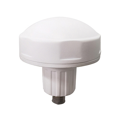
GPS/GNSS Active Timing AntennasThese GPS/GNSS Active Timing Antennas filter and amplify global positioning system signals received from GNSS, Galileo, GLONASS, BeiDou, QZSS, and IRNSS satellite constellations. Timing antennas are used in cellular data and industrial computer networks to recover timing and positioning data for timing reference and phase synchronization. Additionally, these antennas play a crucial role in precision agriculture, ensuring accurate time synchronization for agricultural machinery and monitoring systems, and in marine industries, providing precise navigation and timing data for vessels, offshore platforms, and marine research.Key Features of GNSS & GPS Smart Timing Antennas:- Multi-Constellation Coverage: Supports satellite systems including GPS, GLONASS, Galileo, and BeiDou for global timing and navigation.- Multi-Signal and Multi-Band Support: Offers flexibility with broad signal reception and the ability to operate across multiple frequency bands (L1, L5, etc.).- Low-Noise, Low-Power Drain: Designed to be energy-efficient while maintaining superior signal quality, ensuring optimal performance without excessive power consumption.- Wide Range of Dimensions and Weights: Available in various sizes and weights to suit specific application needs, from compact systems to large infrastructure installations.- Dual Band (L1/L5) Units Available: Provides excellent protection from electronic countermeasures, with outstanding multi-path attenuation measures.- Durable and Weather-Resistant: Engineered to withstand harsh environments and severe weather conditions, offering corrosion resistance, lightning protection, and waterproofing.- Mushroom Head Design: The unique radome shape (also known as mushroom head) prevents water, ice, and bird perching, ensuring reliable performance in outdoor settings.- Highly Stable Phase Center: Delivers consistent and precise time synchronization.- Flexible Mounting Options: Allows for various installation configurations, with compatible mounting brackets and Type N-K connectors.- Ruggedized, IP67 Rated: Fully encapsulated to ensure longevity and reliability even in extreme conditions.- Cost-Effective and Independent Timing Source:** Provides a standalone timing reference for fault detection systems, wireless network synchronization, and other mission-critical applications.Applications:Mide’s high precision GNSS/GPS antenna solutions support timing and positioning applications in the precision agriculture, marine industries,telecommunications networks, financial transactions, scientific research, and transportation systems.Telecommunications: Synchronizing networks for uninterrupted services.Financial Transactions: Enabling time-stamped transactions with high accuracy.Scientific Research: Providing precise timing for data collection and analysis.Transportation Systems: Ensuring smooth operation of time-sensitive systems.Precision Agriculture: Enabling precise agricultural practices, including automated machinery and crop monitoring, by providing accurate timing for GPS-based systems.Marine Industries: Supporting navigation, fleet management, and time-sensitive operations in marine environments, ensuring synchronization across global vessels.Mide is a GNSS & GPS Timing Antennas manufacturer, offering customizable OEM solutions for businesses in need of reliable timing and synchronization services. MIDE ensures that its products comply with relevant industry standards, safety protocols, and international certifications, such as CE and FCC, to meet the regulatory requirements of different markets. With Mide’s precision antennas, you can ensure the most efficient, accurate, and secure operations for your business.


Reliable geodetic-grade GNSS positioningGeodetic antenna has the ability of multi-satellite system navigation and positioning, and can receive various types of navigation system full-band signals. Using unique geodetic grade techniques, the phase center is stable, which provides excellent anti-multipath interference ability and ensures the sensitivity of receiving satellite signals. It is able to receive low elevation signals with high gain and wide beam width makes it an excellent choice for tracking visible satellites under challenging conditions, providing the positioning solutions with precision and reliable data. GNSS geodetic grade antenna can be widely used in agriculture tractors, unmanned vessels, also for autonomy vehicles, GIS surveying where high precision operations are needed. Mide, as a professional manufacturer and supplier of geodetic grade antennas, provides geodetic grade GPS/GNSS antennas, equipment, technology, etc.
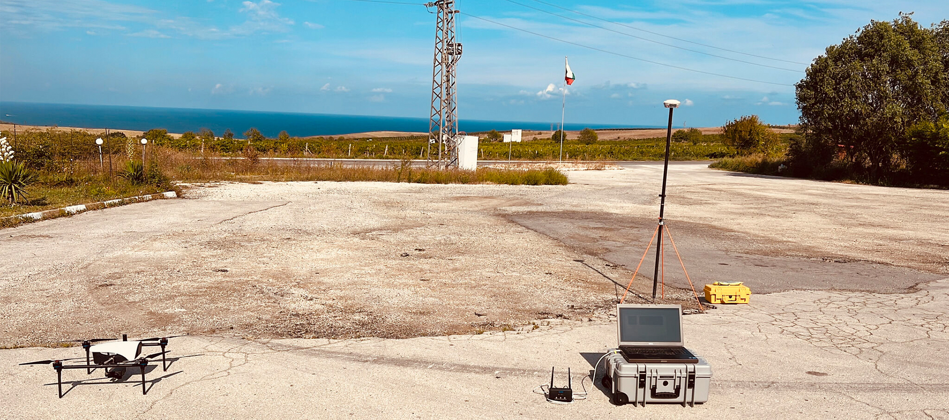
UAV antenna is equivalent to the "eye" of UAV. High-precision positioning supports signal reception of GPS, BDS, GLONASS, GALILEO and satellite-based augmentation systems, providing multi-system multi-directional strong satellite signals to provide centimeter-level positioning accuracy, while effectively dealing with interference between systems in the UAV's long-distance multi-band working environment, so that the UAV always maintains directional fixation during the automatic flight, providing high safety, to ensure the reliability and controllability of the UAV in the work.

High-Precision GNSS for Precision Agriculture & FarmingGPS & GNSS-based applications in precision agriculture farming are being used for Sowing, spraying, auto guidance, harvesting, planting, field mapping. GPS,GNSS allows farmers to work during low visibility field conditions such as rain, dust, fog, and darkness.Smart precision agriculture, also known as precision agriculture or smart farming,which is a comprehensive combination of information technology and agricultural production. Precision agriculture is a comprehensive and integrated high-tech smart agricultural application system specifically for field crop cultivation that has emerged in recent years.

As an industry-leading antenna solution provider in ICV field, Mide actively communicates with host manufacturers and industry partners, discussing the development and application of ICV antenna technology and products. Relying its own advantages of high-precision positioning technology, Mide provides a series of high-precision, high-performance and high-reliability antennas for intelligent connected and autonomous vehicles.

As an industry-leading antenna solution provider in ICV field, Mide actively communicates with host manufacturers and industry partners, discussing the development and application of ICV antenna technology and products. Relying its own advantages of high-precision positioning technology, Mide provides a series of high-precision, high-performance and high-reliability antennas for intelligent connected and autonomous vehicles.
Survey Mapping & Geodetic
Reliable geodetic-grade GNSS positioningGeodetic antenna has the ability of multi-satellite system navigation and positioning, and can receive various types of navigation system full-band signals. Using unique geodetic grade techniques, the phase center is stable, which provides excellent anti-multipath interference ability and ensures the sensitivity of receiving satellite signals. It is able to receive low elevation signals with high gain and wide beam width makes it an excellent choice for tracking visible satellites under challenging conditions, providing the positioning solutions with precision and reliable data. GNSS geodetic grade antenna can be widely used in agriculture tractors, unmanned vessels, also for autonomy vehicles, GIS surveying where high precision operations are needed. Mide, as a professional manufacturer and supplier of geodetic grade antennas, provides geodetic grade GPS/GNSS antennas, equipment, technology, etc.
UAV
UAV antenna is equivalent to the "eye" of UAV. High-precision positioning supports signal reception of GPS, BDS, GLONASS, GALILEO and satellite-based augmentation systems, providing multi-system multi-directional strong satellite signals to provide centimeter-level positioning accuracy, while effectively dealing with interference between systems in the UAV's long-distance multi-band working environment, so that the UAV always maintains directional fixation during the automatic flight, providing high safety, to ensure the reliability and controllability of the UAV in the work.
Precision Agriculture
High-Precision GNSS for Precision Agriculture & FarmingGPS & GNSS-based applications in precision agriculture farming are being used for Sowing, spraying, auto guidance, harvesting, planting, field mapping. GPS,GNSS allows farmers to work during low visibility field conditions such as rain, dust, fog, and darkness.Smart precision agriculture, also known as precision agriculture or smart farming,which is a comprehensive combination of information technology and agricultural production. Precision agriculture is a comprehensive and integrated high-tech smart agricultural application system specifically for field crop cultivation that has emerged in recent years.
Robotics
As an industry-leading antenna solution provider in ICV field, Mide actively communicates with host manufacturers and industry partners, discussing the development and application of ICV antenna technology and products. Relying its own advantages of high-precision positioning technology, Mide provides a series of high-precision, high-performance and high-reliability antennas for intelligent connected and autonomous vehicles.
Vehicles
As an industry-leading antenna solution provider in ICV field, Mide actively communicates with host manufacturers and industry partners, discussing the development and application of ICV antenna technology and products. Relying its own advantages of high-precision positioning technology, Mide provides a series of high-precision, high-performance and high-reliability antennas for intelligent connected and autonomous vehicles.
ABOUT US
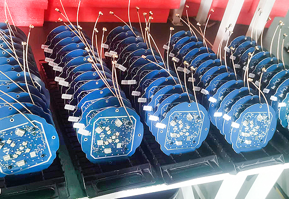

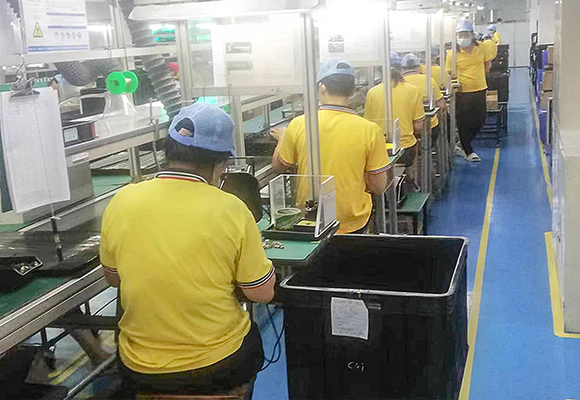

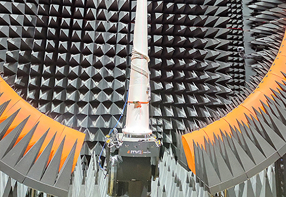
Backed by our team dedicated to GNSS technology, GNSS products you choose from us today will be never outmoded in the future.
MIDE is a professional manufacturer of satellite navigation and positioning equipment, focusing on the research and development, production, and sales services of high-precision satellite navigation and positioning, mobile satellite communication, mobile communication, receivers, and RF modules. The product is widely used in survey mapping, UAV, deformation monitoring, Vehicle, Robots digital construction, aerospace, navigation, smart cities, autonomous driving, mobile communication, precision agriculture, and military fields.
Let us show you how to integrate GNSS technology into your projects.

Expert in GNSS antenna R&D and production
We focus on accurately positioning GNSS technology and providing innovative solutions for military, commercial, and research COTS (Commercial Off the Shelf) integrated products.

World leader in GPS/GNSS antenna field
As a leading enterprise in the field of satellite positioning antennas in China,MIDE has a sound R&D system, attaches importance to the cultivation of scientific and technological innovation talents, continuously increases investment in R&D technology

Independent intellectual property rights
Our products have completely independent intellectual property rights and are protected by patents, we have had more than 30 patents.

Reliable in quality, and industry-leading
Our customer for ComNav Technology has realized auto- parking and auto- taking,positioning accuracy is with 2cm.

Expert in GNSS antenna R&D and production
We focus on accurately positioning GNSS technology and providing innovative solutions for military, commercial, and research COTS (Commercial Off the Shelf) integrated products.
Mide is the professional manufacturer (OEM) that develops and manufactures GNSS antennas and Receivers for high-precision positioning applications worldwide.
Dec. 19, 2024
How to Choose the Right GNSS Receiver for Your Needs
Global Navigation Satellite System (GNSS) receivers have become an indispensable part of modern navigation systems. Whether you're a surveyor, an engineer, or an outdoor adventurer, choosing the right GNSS receiver is crucial to ensuring accurate positioning and timing. In this article, we'll guide you through the key factors to consider when selec
Dec. 06, 2024
The Future Light Of Indoor Precise Positioning
This article proposes a fusion positioning algorithm of 5G+UWB, which significantly improves the accuracy and stability of indoor positioning by combining the advantages of both technologies.
Nov. 21, 2024
Low Cost And High Precision: a New Breakthrough in GNSS, IMU, and LiDAR Integrated Navigation
In modern navigation and positioning technology, how to improve the anti-interference and accuracy of navigation and positioning under the conditions of low-cost satellite receivers and inertial measurement units (IMUs) has always been an important research topic.
Nov. 06, 2024
How Does a GNSS Receiver Work?
Global Navigation Satellite Systems (GNSS) receivers are essential devices in today's world, enabling users to determine their precise location anywhere on Earth. By leveraging signals from satellites orbiting the planet, these receivers can provide positioning, navigation, and timing information. In this article, we explore how GNSS receivers w
Oct. 25, 2024
A New Breakthrough in Precision Single Point Positioning with Multi Frequency Signal Assistance
With the continuous development of Global Navigation Satellite Systems (GNSS), Europe's Galileo system has become a leader among them.
Oct. 10, 2024
Applications of Geodetic Antenna
This article explores the various applications of geodetic antennas and their significance in modern technology.
Sep. 19, 2024
What Are the Benefits of Geodetic Antenna
Geodetic antennas play a crucial role in modern surveying and geolocation applications. Designed to support high-precision measurements, these antennas offer numerous advantages that make them indispensable in fields such as geodesy, land surveying, and navigation. This article explores the key benefits of geodetic antennas and their importance in
Sep. 06, 2024
Advanced Noise Reduction Technology Helps Improve The Accuracy of Mining Subsidence Monitoring
In modern mining, accurate monitoring and analysis of mining subsidence are important links to ensure safe production.
Aug. 21, 2024
Breaking Through The Difficulty of Robot Localization in GNSS Denial Environment
In today's era of intelligent development, mobile robots have become important tools in many industries. However, achieving high-precision positioning remains a huge challenge in environments where Global Navigation Satellite System (GNSS) signals are limited or denied. In response to this issue, researchers have proposed an improved adaptive ge
Aug. 07, 2024
Geodetic antennas are essential tools used in geodetic surveying, a precise method of measuring the Earth's shape, orientation, and gravitational field. These antennas play a crucial role in collecting data for various applications such as mapping, navigation, and monitoring tectonic movements. In this article, we will delve into the workings of ge


Request a Quote
